 To be honest, up to a few months ago i hadn't really heard of Sint Maarten *blushing*. then my friend told me that he decided to go there to look for sailing jobs. i immediately looked it up and when i saw this map i thought 'wow, this just looks so unique!' and being situated in the Caribbean, it just cant be but beautiful in nature..!
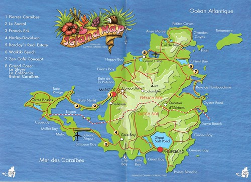
The island is actually divided into two parts: northern French part Saint-Martin and southern dutch part Sint Maarten - this division dates back to the year 1648. Its situated some 300 km east of Puerto Rico, being a part of Leeward Islands/Lesser Antilles.

 Well planes are normally not my passion (unless they are taking me someplace new ;)) but it is pretty cool how they fly over beaches here...
They ran out of stamps in the PO so they used this sticker stamp, which still sez 'Nederlandse Antillen' - but in fact Sint Marten was part of it until 10/10/2010, when it became a separate constituent country (as did Curacao), and the rest of the islands joined the Netherlands as 'special municipalities'. not at all complicated! heh.
Thank you kiwi friend for finding time to post this card for me!
Nema komentara:
Objavi komentar